We can use your data together with the many specialist environmental datasets we hold to produce maps and visualisations. We can even set up a simple online portal using Google Maps to allow your staff or visitors to capture data which we can then import into our full-featured GIS for further analysis.
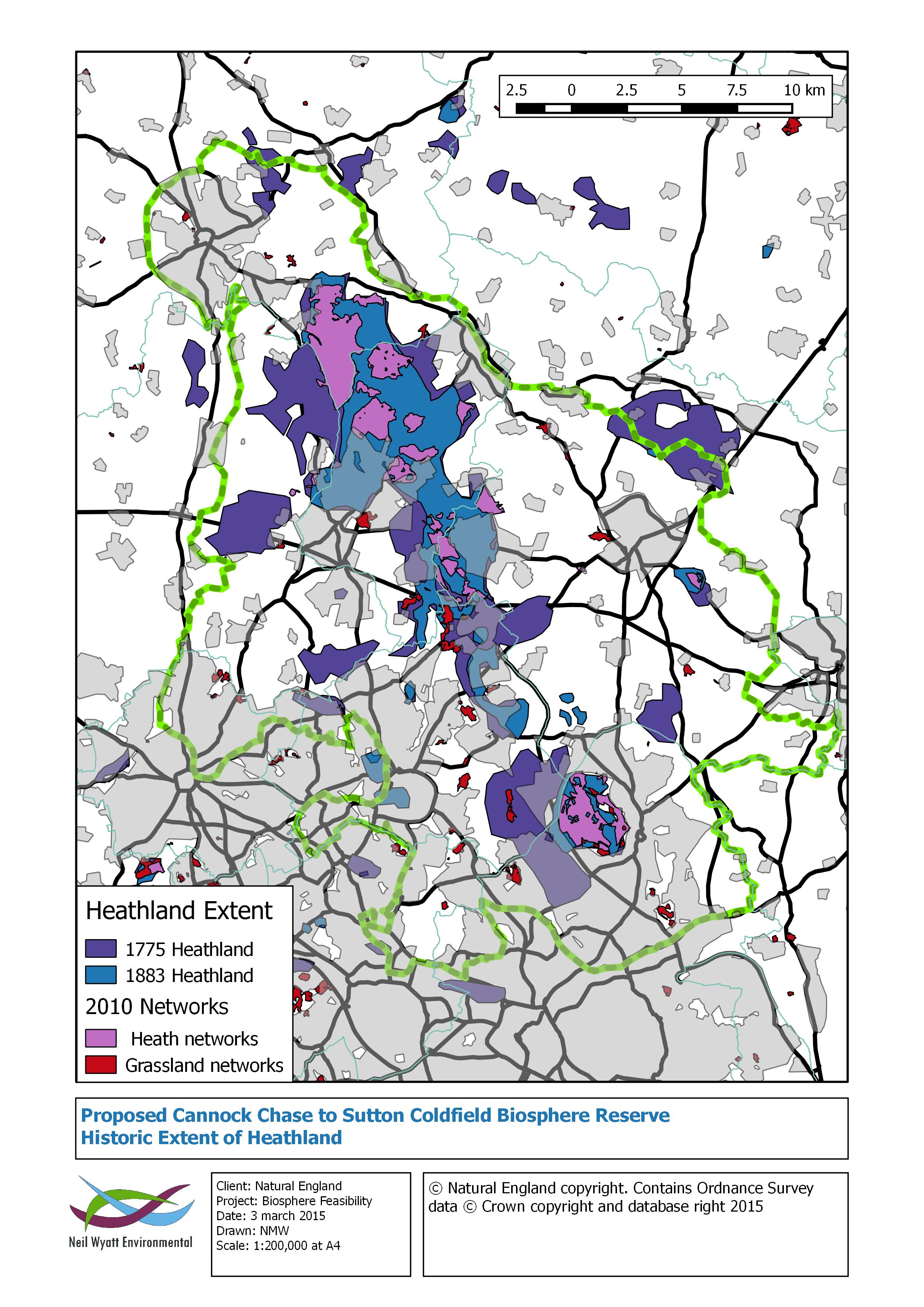
The example map below shows how the extent of Heathland in the West Midlands has shrunk between 1775, 1883 and 2010.